 |
Ken Baldry's Alpine PagesHis best-ever day in the hills - The Balfrin ridge |
Wednesday 7th September 1977. Along the Balfrin ridge.
This was the high-point in every sense of a formidable Swiss tour which also took in the Lagginhorn 4010m. The previous day, my first wife Jane & I had climbed the Nadelhorn 4327m and still my high point. For this, we stayed in the Mischabel Hut 3300m and above Saas Fee in the Swiss Valais. We stayed another night before this expedition....
A couple of views from the Mischabel Hut the evening before...
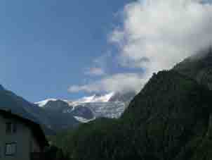
 Weissmies 4013m to the East |
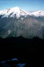
 Taschorn 4490m and Dom 4545m . |
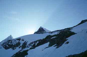
The Lenzspitze from the hut (Dom left). |
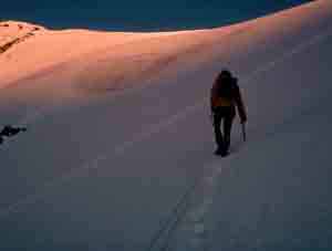
You need an early start for a serious Alpine trip and, on this day, we were out of the hut by 0430. We went across the Hohberg Gletscher (glacier) to the foot of the Windjoch but bore East. The rest of the climbers, the various Sally Lightfeet (a sort of spider) , Jane called them and went up to the pass. The last bit was rock, which we had not expected. The gradient of the whole pass on the Hohberg side is moderate but is horrendous the other side. We went up the Ulrichshorn 3925m, an easy plod and then followed part the way on a track to the Hohbergjoch. The photo of me on the Alpine Home page is on top of the Ulrichshorn.
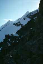
 Approaching the Windjoch 3850m first thing in the morning. |
Coming down from the Ulrichshorn to the Ried Pass. The route up from the Windjoch is behind the Ulrichshorn. Right of which: Lenzspitze 4294m (just peeping), Nadlehorn 4327m, Stecknadelhorn 4242m |
 The Balfrin ridge seen over the Ried Gletscher from the Nadelhorn East ridge. Right to left are the South Balfrin 3795m, the North Balfrin 3789m and the Gross Bigerhorn 3625m. Ulrichshorn off to the right. |
 From the Ried Glacier looking south. From the left: Monte Rosa 4634m with the Allalinhorn 4027m in front of it, Rimpfischorn 4199m, Lyskamm4480m and Alphubel 4206m, Ulrichshorn |
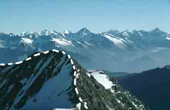
The South Balfrin from the Ulrichshorn 3925m. The high peaks in the Bernese Oberland, seen left to right are the Jungfrau, Monch, Aletschorn, Fiescherhorner, Grunhorner & Finsterarrhorn & the Aletsch Glacier (biggest in Europe) below it. |
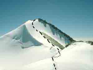
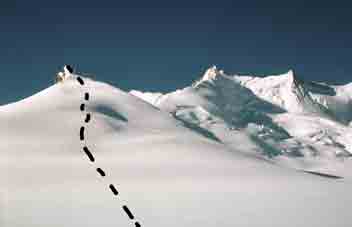
The South Balfrinhorn from the North with the route down. Watch out for the cornice on the left. |
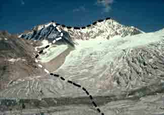
We branched off in echelon over virgin snow down to the Ried Glacier firn (see the photo below) and headed over to the Balfrin, at who's foot, we stopped for lunch. The South Ridge is only F but is loose scrambling, not Jane's bag. We stopped until the food got to her boots. People waved to us from the Nadelhorn. The exposure on the Saastal side of the South Balfrinhorn is fantastic. Cornices, too. The top is beside a snowfield which is firn from the Balfrin Glacier. It is quite a long snow plod to the North Balfrinhorn but they are both about 3790m high. On the photo, the route is visible to the top of the South Balfrin but is dotted where it goes down the snow slope behind the ridge.
North Balfrinhorn from the South one |
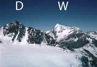 From the North Balfrin left: Durrenhorn 4034m & Weisshorn 4505m |
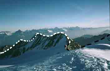
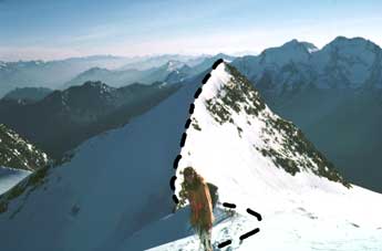
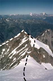
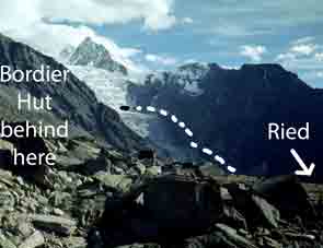
Right: the North Balfrinhorn with the route to the Gross Bigerhorn, down to the Bordier Hut & across the glacier |
We had been soloing from the foot onwards. There was another snow plod with a pleasant rock finish to the Gross Bigerhorn 3625m. The view gets better and better from this string of summits, as more of Austria and Italy becomes visible from round corners.
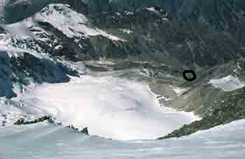 The Ried Glacier from the North Balfrin. |
 The Gross Bigerhorn from the North Balfrin |
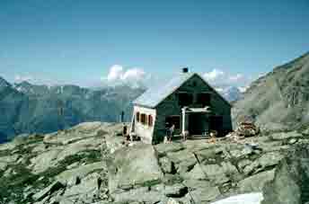
The Bordier Hut. |
Although one loses height, the Gross Bigerhorn is still as high as the Blumlisalphorn for example. It is only relatively low, locally. In the other direction, the Nadelgrat forms a tremendous backdrop and the Weisshorn becomes visible, with all the detail of its upper ridges and glaciers. It is a steep and rather unclear route down from the Gross Bigerhorn to the low point before the insignificant Kleine Bigerhorn and from there, one slides, slips and glissades down to near the Bordier Hütte. This is Much easier than it looks on the photo above. We looked in for lunch, the Wirt boiling our last soup. (He was sleeping in the sun when we got there and had to be wakened to his duty). We followed the marked path across the Ried Glacier very broken up hereabouts. Interesting. (This route will change from year to year). Then, a long, long way down to the sheep country and woods of Ried.
The Ried Glacier from Heidnisch Tossen showing the route down the moraine. |
Looking up the Ried Glacier from Ried in 2008. |
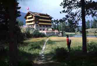
At last, the Hotel zum See above Grächen with me in 1972. |
We could not find the water track to Grächen but, in the end, saved time by using a new road which goes round the back of the See, joining it from the Waldwanderweg. We got to the Hotel Zum See at 1830, having been 14 hours on our journey. Frau Buhler was mock-horrified by our journey and it had been an epic worthy of our mock-fore-fathers. A couple who had been in the hotel the previous week remembered us and we had to have an account of our doings, of course. We had a room with a shower and it was only two francs more - 31 for half board. Those were the days - 1977.
Contact: Ken Baldry, 17 Gerrard Road, Islington, London N1 8AY +44(0)20 7359 6294 or e-mail him URL: http://www.art-science.com/Ken/Alpine/Big_day/index.html Last revised 17/10/2010 © 1998-2010 Ken Baldry. All rights reserved.