 |
Ken Baldry's walks around Saas FeeAlpine Option - The Nadelhorn 4327m |
This climb is a two-day operation, which starts with the walk up to the Mischabel Hut, well sign-posted from the village. The guide book calls it 'a noted slog', which it is if you don't keep turning round to look at the ever-increasing view. Anyway, you have all day to go up, so why make a misery of it? There are dozens of zig-zags to start with, which at least, gets you some height quickly. Later, it is rocky & there are usually snowy sections but this is all peril-free.
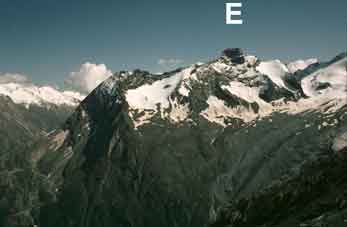
The Egginer 3366m right & Mittaghorn |
The Bietschorn 3934m in the Berner Oberland |
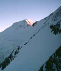
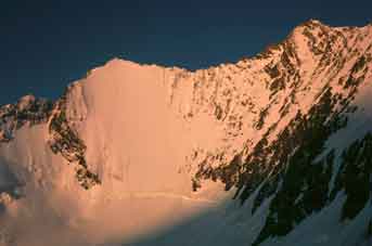
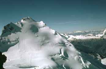
The last rays of the Sun on the Alphubel |
Next morning...
The hut Wirt (landlord) should wake you up at about 3:30 to 4am & after a bleary breakfast, you start up the rocky ridge above (West) the hut to the edge of the Hohberg Glacier. Stop, put on your crampons & rope up for the relatively flat crossing NW of the glacier to the obvious low point on the ridge between the Ulrichshorn (3925m) on the right & the Nadelhorn on the left. This is the Windjoch & ther will probably be a trail to and up it, which bears left & comes out on the NE ridge of the Nadelhorn above the joch. This can be an awkward step for the last bit. (It was for us). The glacier was quite safe in September 1977, with few crevasses but might have deteriorated since. The sun rises behind the Weissmies opposite & the first rays hitting the Dreieselwand (3 donkey's Wall) of the Lenzspitze (4294m) are really something.
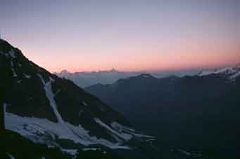
The Sun rises behind the Weissmies |
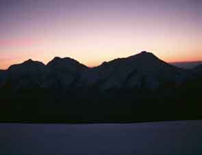
Frst rays hit the Dreieselwand on the |
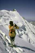
The Ulrichshorn 3925m from |
We started walking up the ridge westwards, which gets steeper as you go & becomes an unlovely mixture of steepish snow with blades of rock sticking through until the summit. We started at 0430 & were up at 0930, fairly slow. As with all high summits, the lower peaks tend to disappear & Jane had trouble locating the Matterhorn, which is not much higher. One goes back the same way but with more caution! The views tend to be different on the way down, because the Sun is further up.
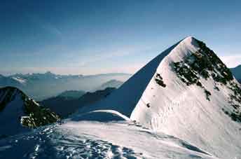
The author on the Nadelhorn Ostgrat (East ridge) with the Stecknadelhorn 4242m behind. |
The view of the Weisshorn 4505m |
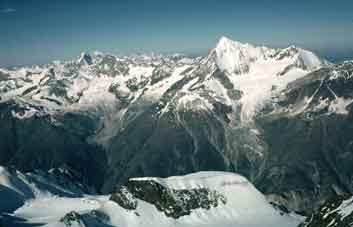
The mighty Dom 4545m South of the Nadelhorn from the summit. Gran Paradiso in Italy to its right. |
Back at the hut, you can face the stiff walk back down to Saas-Fee or stay another night & escape the area by using my 'best day in the Alps' option over the Balfrin range to Grächen above the Mattertal.
Contact: Ken Baldry, 17 Gerrard Road, Islington, London N1 8AY +44(0)20 7359 6294 or e-mail him
URL: http://www.art-science.com/Ken/Alpine/Saas_Fee/saasfee4.html Last revised 15/10/2010 © 2000-2010 Ken Baldry. All rights reserved.