 |
Ken Baldry's Alpine PagesWalks around Lenk 1068 m |
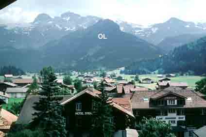
Lenk is at the head of a side valley from the Simmental in the Bernese Oberland.
How to get there
Take the Montreux Oberland (MOB) train from Montreux on Lake Geneva or the other way from Spiez on Lake Thun. Then alight at Zweisimmen & take the branch line to Lenk. Main lines trains go from Geneva Airport to Montreux & from Zürich Airport to Bern & change for Spiez (BLS trains). Alternatively, walk in from the East or West from the Cross-Swiss walk on this link. When you get there, check the times of the Iffigenalp bus, as three walks optionally use it.
When you get there...
...you need somewhere to stay. I have stayed at the simple Hirschen, the posh Wildstrubel & the Waldrand in between.
|
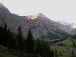
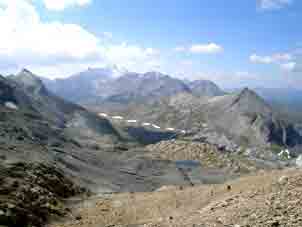
Photo left: The dark hill in the middle is the OberLaubhorn, I have done all these walks myself. |
First afternoon walk - the Simmen Falls
Walk South up the valley by several alternative footpaths. They all lead to the falls to the left of the valley. The path goes up beside the falls (I seem to remember paying something negligable) & you may get wet from the spray. These are more like steep rapids than ordinary waterfalls but quite spectacular all the same. Café at the top in the Simmenfalle Hotel & then, you come back down. If you walk in from the Engstligenalp on this link, you pass the falls on your way down.
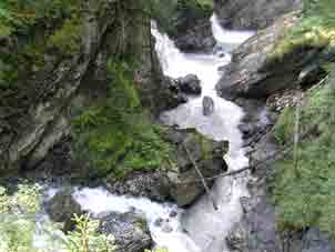
The higher falls |
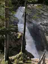
The fall by the Barbarabrucke |
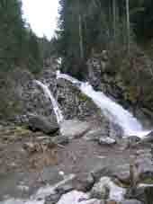
The lowest fall |
Take the bus up to Iffigenalp, where the path for the pass is clearly marked. (You can walk up in 2 1/2 hours). We got the 0900 bus, a Toyota mini-bus, to Iffigenalp which buys you 1500' & several miles. The falls are quite spectacular & the road zig-zags perilously up by them. Goodness knows how the big bus gets up.
The Rawil Pass path goes across these cliffs |
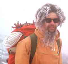
The author with ice condensed on him |
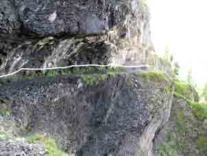
The path has some fixed rope, |
The road is timetabled - 1/2 hour one way & 1/2 hour the other. The pass path progresses up the cliff wall to the South of the alp &, as one would expect in July, the path was blfrom right to left. It's quite safe!
The author with ice condensed on him
on the Rawil Pass in June 1979.
The path has some fixed rope,
which I have exaggerated
The road is timetabled - 1/2 hour one way & 1/2 hour the other. The pass path progresses up the cliff wall to the South of the alp &, as one would expect in July, the path was blanked off in places by snow & at one place, someone had tunnelled underneath the snow to stay on the path, so an ice axe is more than useful.
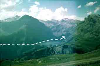
The Rawil Pass, South side. The path goes up towards |
The Rawil Pass, North side, seen Westerly from the Wildstrubel Hut |
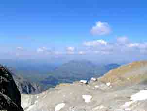
Like most Berner Oberland passes, this one flattens out towards the top on both sides. The top is called the Plan des Roses, a stony waste with struggling flowers. I wonder how it got its name? The pass path is good all the way - it was once the principal route over the Bernese Oberland. Down the other side, there is a view across the Valais but, in the foreground is the Tseuzier Dam, dry on both sides, as it started to move & they drained it fast. From the dam, either get a bus via Botyre into the Rhone Valley (which we did in 1979) or cross the dam (recommended) & walk the eight mile up-&-down 'contour' path to Crans, high on a shelf above the Rhone Valley (done in 1982) & pick up another tour on this link.
If you want a tougher (!) way out...
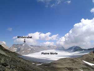
There is a path signposted to the Wildstrubel Hut after getting past the cliffs & on towards a hut in the valley above. The Wildstrubel Hut is at 2791m, will supply you with a much-needed beer & neither at the top, quite, nor well-placed for climbing the Wildstrubel. (This is best done from the other side on this link). Carry on up the path & (probably) up a snow field to another scratchy path below a cliff. (Above, to your left, you can see a military installation fed by a cable car from the Iffigenalp. You can't use it!) Then, there is a bit of a scramble & a nasty but short path down (the hut is on the wrong side of the ridge) to where the old path has fallen off. After that, there is a good route with the Wildstrubel in front of you over the Plaine Morte Glacier, which you do go on to climb the Wildstrubel. But carrying on, this path takes you to the cable car station for Montana or you can walk down on good paths & jeep tracks to the village.
The Wildstrubel Hut from above the snow field. |
The path right goes to the cable car station |
In 2005, I came over the path from The Sex Morte (cable car station but I had walked up) to the Wildstrubel Hut on my way down to the Iffigenalp. The path I had used before had disappeared in the winter, as they sometimes do & there was a rather scratchy alternive to the North, clearly marked but rather unpleasant. Then, a slope of hard snow down to the hut.
Contact: Ken Baldry, 17 Gerrard Road, Islington, London N1 8AY +44(0)20 7359 6294 but best to e-mail him URL: http://www.art-science.com/Ken/Alpine/Lenk/index.html
Last revised 23/6/2013© 2001-2013