 |
Ken Baldry's walks around Saas FeeFrom the Simplon Pass down the Italian side (completely revised 20/9/2014) |
Ways to Saas-Fee:- Day 1: Up the Simplon mule track (away from the modern road)
Day 2: The passes (either Usseri Nanzlichi or Bistinen) & the Gebidem Pass to Gspon
Day 3: The Gspon Hoheweg to Saas Grund
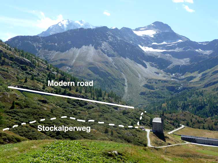
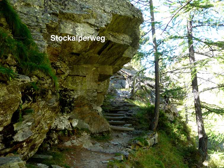
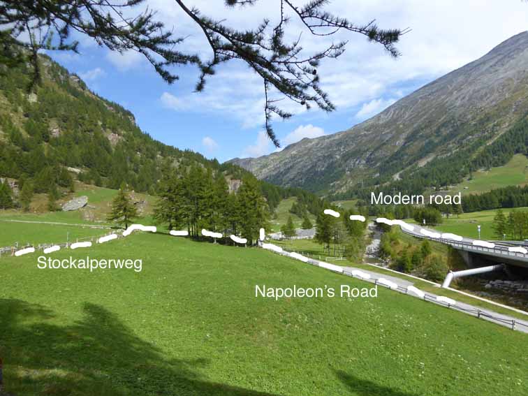
From the Hospiz, the Simplon Pass proper goes down to Gondo, a small village which is just 1km short of the Italian frontier. While I had walked up in 2008, that was to go to Saas-Fee & I did not walk down it until 2014. The Stockalperweg is, largely, a good pack-horse track on this side, too. From the Simplon Hospiz, go left & cross the road to the pink Hotel-Restaurant Monte Leone. Go down the concrete slope to the left of the hotel &, following the brown, distinctive, Stockalperweg signs (see the middle photo below), soon turning off onto the pack-horse track, in perfect condition here. This is always to the right (going down) of the modern road until briefly after Simplon Dorf (dorf = village) & later, in the Gondo Gorge. It passes the Spital watch-tower & goes into woods. Occasionally, bits of modern side road drop down from the main road but it is usually made clear, either by the brown signs or blue paint splashes on the route, where to go.
The Stockalperweg from the Bistinen Pass path |
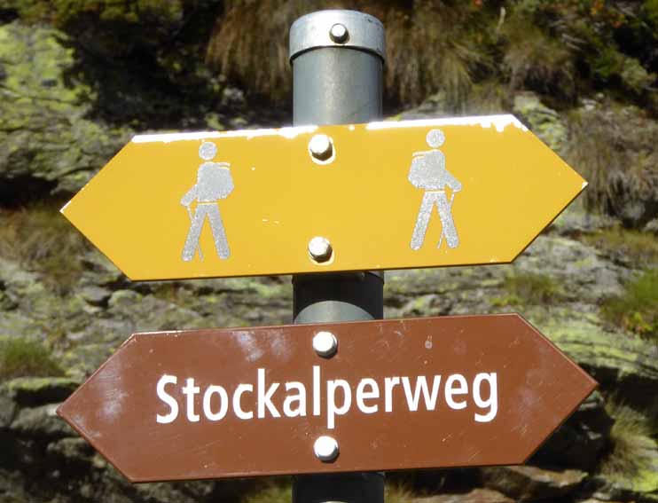
Watch out for these signs. |
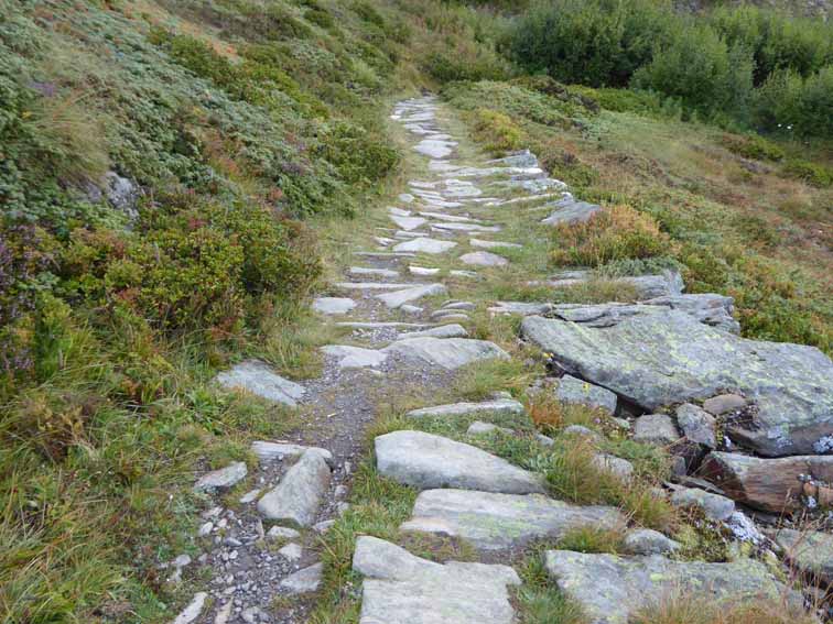
The Stockalperweg starts well |
Round by the Spital Watch-tower |
On the Stockalperweg in the woods |
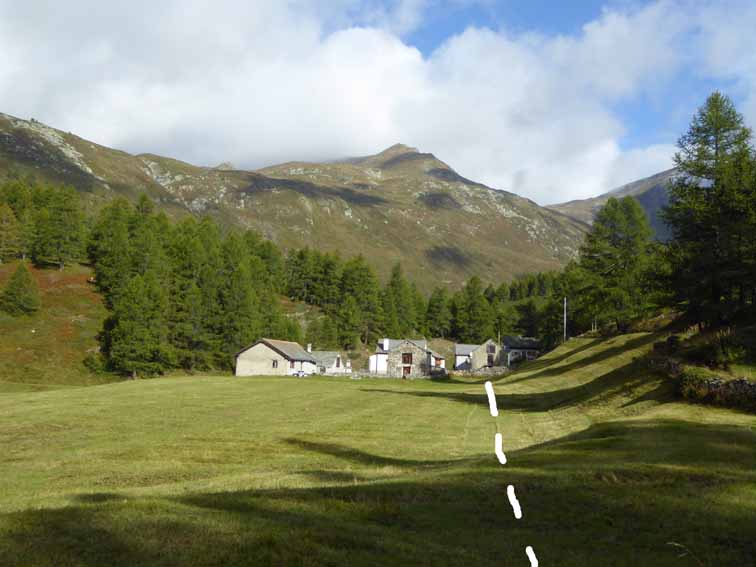
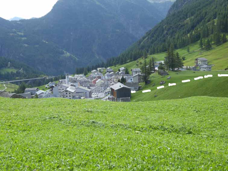
1st village - Nideralp |
The Sun came out properly & I stopped to put on sun cream. Before the Maschihüs village, the path is occasionally in between walls, presumably to stop the pack-horses eating the hay in people's meadows. There are a few yards before Simplon Dorf where the path joins the Napoleon road but gets back up into the woods as soon as it can. See the right-hand picture below.
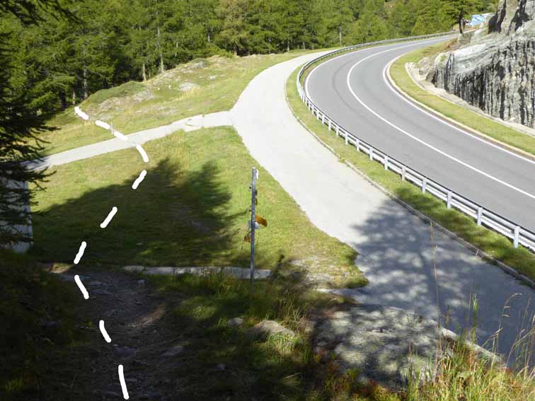
Touches but does not cross the main road here |
2nd village - Maschihüs & path between walls |
The three different routes |
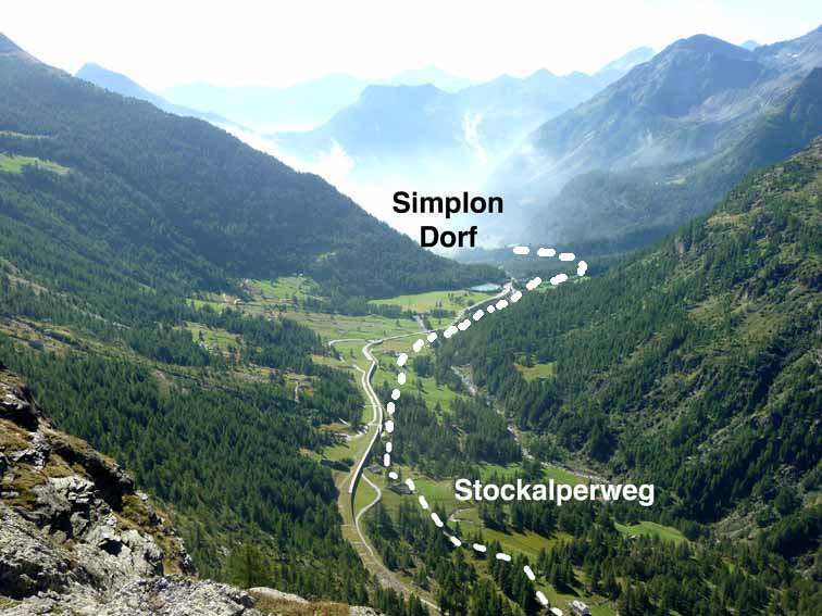
The filled-in lake above Simplon Dorf |
Into Simplon Dorf |
Simplon Dorf |
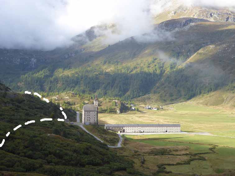
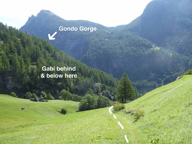
Simplon Dorf was Very Quiet. On the other side, where one takes the Napoleon road, the sign said Gondo 9km but the abbot at the Hospiz said it was 20km & I did not think Simplon Dorf was half way. I am sure it wasn’t, as when I got to Gondo, it had been 25,500 paces roughly. This is over 11 miles & 18km. The Napoleon road ducks under the main road but the Stockalperweg soon drops off to the left & goes down, with the first real muddy patches, to close above Gabi village but crosses the main road before Gabi & goes into the woods on the South side of the gorge. This path goes up & down a bit & can be slippery, as it never gets the Sun.
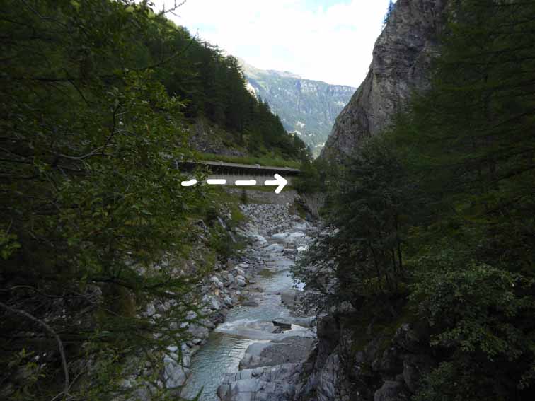
Off the Napoleon road to Gabi |
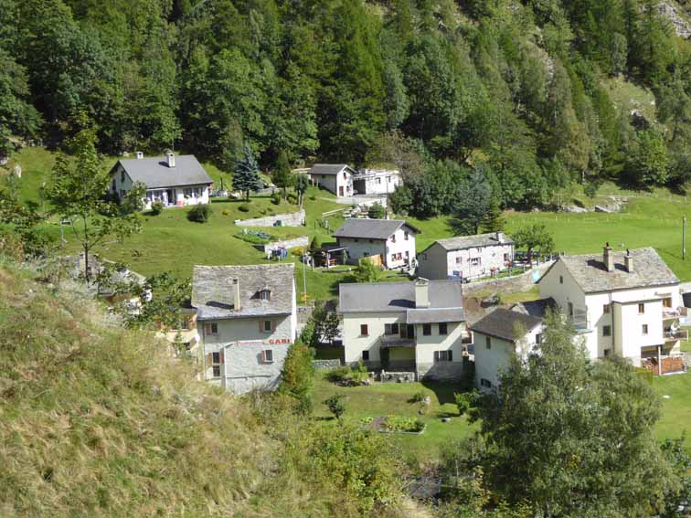
Gabi |
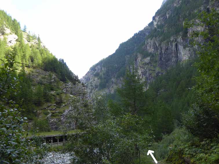
Along the gorge, 1st section |
There is a new footbridge to the Alte Kaserne, Napoleon’s barracks but one does not cross this. A few hundred metres later, one crosses a wooden bridge which takes you to the main road, now largely in an avalache box. The path runs outside the box, sometimes on metal, where there is no space for a solid one. This ducks under the main road & one goes up a metal staircase which takes one into the woods on a woodmans’ track, which eventually crosses the main road box & runs on a badly maintained section of the Napoleon Road until it does the steps up & over trick again. I’m not quite sure of the sequence here but the track again crosses onto the old road. However, one does not continue into Napoleon's tunnel. It goes up more iron steps to the right, to an old fort, Fort Gondo (but still some way above Gondo) guarding the bottom of the pass & built into the rock. One goes into the fort & along narrow but lit tunnels for quite a distance, which probably feels longer for being underground.
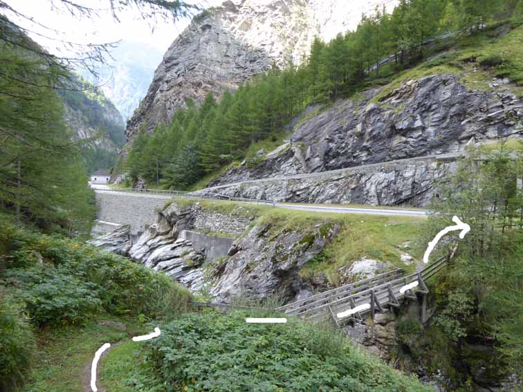
The bridge one does cross |
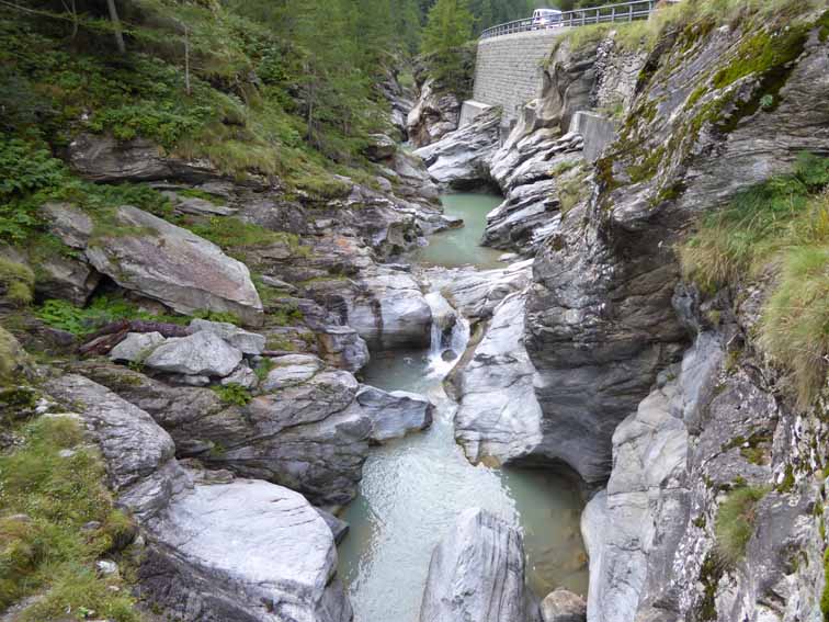
Down in the gorge |
The path outside the avalanche box |
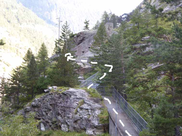
The path goes up to Fort Gondo |
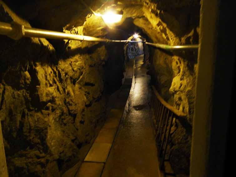
The path inside the fort |
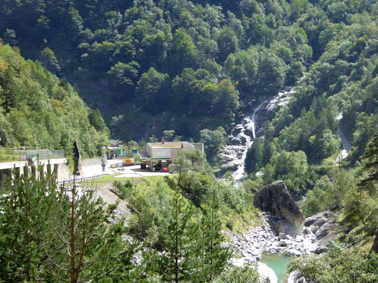
On top of the avalanche box & Gondo |
At the other end, the path is well above the road, so drops in zig-zags & for the very first & only time, comes out on the pavement of the main road for a couple of hundred yards. Avis, my wife, had stayed at the Hospiz for a walk there, then drove our van down, past me there & waved, an extraordinary co-incidence. The road then makes zig-zags but the Stockalperweg drops off left into the woods & comes out on top of the main road avalanche box. About 15 minutes after seeing her, I dropped down to the first petrol station in Gondo, where she had parked.
Warning! In 2010, on the Kummerly & Frey map, a high-level footpath is shown from the southerly road into the Simplon Hospiz (which is set back from the main road) which should lead to Gondo. This path is badly way-marked & keeps disappearing. I tried to follow it but eventually, gave up & dropped down onto the filled-in glacier lake above Simplon Dorf. I crossed to the main road avalanche shed but could only rejoin the Stockalperweg by walking South (down) along the top of the shed until a side road allowed me to cross to the Stockalperweg, then made my way up to the Hospiz at the pass again, as I was to do the Fulmoos Alternative on this link the next day.
Contact: Ken Baldry, 17 Gerrard Road, Islington, London N1 8AY +44(0)20 7359 6294 or e-mail him
URL: http://www.art-science.com/Ken/Alpine/Saas_Fee/saasfee11.html Last revised 20/9/2014 ©2010-2014 Ken Baldry. All rights reserved.