|
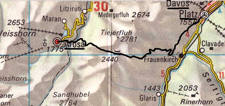
Thursday 19th July Davos to Arosa LK248
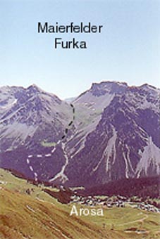
Up early. I told Heeb (who has since retired) that we would be back in 1992 for ski-ing. (1993, actually). I set off up through the Brüchwald where the old short-cut on the map has disappeared but there is a new and very steep and dangerous one to Erb Alp. Strictly for going up and wired off at the top. The contour path to Stafelalp was no such thing - one of those that go up and down all the time and wears you out for no height gain. (It might be a better idea to walk down the road to Davos-Frauenkirch & go up from there but that is not what I did). Then, it is uphill all the long, long way to the Maierfelder Furka 2440m, but not quite so far down to the valley bottom at 1640m. One sees Arosa 1734m after about half an hour, tantalisingly up the other side of the valley, so I had to creep up a couple of hundred extra metres from the bottom, when my feet were aching. I booked in to the Central Hotel, just below the church for three, maybe four nights.
While I was waiting in the bar for the reception staff to turn up, I had a long chat in German to a Swiss woman, married to a German, who is one of many cross-country runners here. One overtook me going over the Furka.
|
 |