 |
Ken Baldry crosses Switzerland on Foot -The Klausen Pass from Braunwald to Unterschächen & Brüsti |
 |
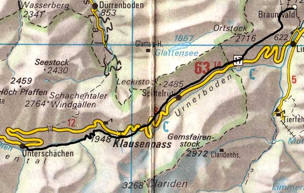 |
On paper, this was The Big Day, although I don't think it was any bigger than Thursday last (Kunkels Pass). I set off in the mist again towards Nüssbuhl 1263m, which cleared by time I got there, giving me the good views of the Tödi. This path was a mistake, as I should have cut off towards Urnerboden on a higher one, clearly signposted. From Nüssbuhl, the path down to the Klausen Road at 1147m must be one of the most unpleasant in Switzerland. This map & the one below are copied from the Official Map of the Automobil-Club der Schweiz, (with their permission) which is on this link but not to scale. |
At one point, it goes under a cliff waterfall and then down the actual stream with no possible alternative. It is necessary to walk (now pleasantly) up the Klausen Road through the Urnerboden, one of those friendly-feeling valleys. I stopped for a beer before Urnerboden Village.
 Urnerboden village with the |
 The Klausen Pass from the West |
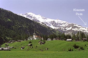
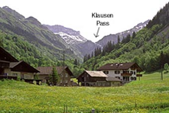
After, it is possible to cut off the road three times, although the first is not marked on the map. The last was onto snow fields and I kicked steps up to the top of the pass, where there is an alcohol free café at 1948m. It took less than 6 hours to get up. The other side is all pack-horse track, the top part badly maintained. There is confusion on the map in the cwm ending at Unter Balm 1729m, just above the steep drop. When I eventually found the pack-horse track again on the south side of the cwm, it goes steeply down into the Schächental with the pass motor road a long way above and quickly forgotten. It is very pretty and a sort of secret valley. A little cow village call Äesch 1250m, lies at the bottom but has no pub and water was running low. But it was only an hour's stagger along the valley floor to Unterschächen 995m and the Hotel Alpina. Cheap and I booked in for two nights, as I wanted to explore the Brünnital which goes off to the south here.
|
Wednesday 1st June 1994 A rest day - The Brünnital Trip As Kev Reynolds says, like the Lauterbrunnen Valley but prettier. I wound up the East side to Trogenalp 1511m and circled round to Brünnialp village at 1402m. No pubs but a lot of over-friendly cows after sugar lumps and sarnies. The valley has the same overhanging waterfalls as Lauterbrunnen but the end is dominated by the huge cliff of the Gross Windgallen. (It is possible to escape to the West and walk over to Erstfeld, a long trip as there is no accommodation in the valley. This, I did in 2006, so see the alternative route on this link below). I met a pair of Germans and walked down with them, getting in much language practise. We saw a Slow Worm which wriggled away then decided it had better square up to us. Another lovely, sunny day. The waitress in the hotel thinks I'm a rapist. She should be so lucky - no energy. After dinner, I rang home. My cousin Lily (on cat-sitting duty) answered to my surprise, as she should have gone home days ago. Avis, my wife, has pneumonia and is still in Wales on her second course of anti-biotics. Lily and I will have to handle the Private View of her Print Show and Party on Saturday but 'I was not to worry'! |
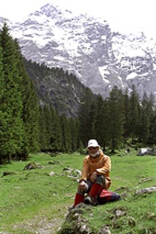
Ken in the Brünnital |
The Original Route:-
Thursday 2nd June 1994 Unterschächen to Attinghausen (less-than-half-day walk) LK246
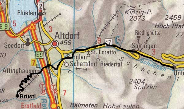 |
Of course, I worried all day. I set off at 9 mostly by the road but with some welcome stretches of path. I avoided Burgen with its phoney Wilhelm Tell culture and cut across the fields to Schattdorf, where things went wrong. I expected to be able to walk along the river bank (Schächen) but it was wired off for an arms factory. Great! This is not obvious from the map. (See the alternative route, which does go through Bürglen & down the other side of the stream). So, I had to cut round through an industrial area to get to the road to Attinghausen 469m. Cable car, 10 mins it said but when I got there, I did not recognise it. There are two and it was 400 odd feet up to the second one at 597m, which I did recognise. I went up the path, more snakes and down by the road. |
There was a road, then footpath to Fluelen on the Lake of Lucerne and I caught the 1500 boat to Lucerne.
If you are doing this walk 'in one', continue from Attinghaisen up to Brüsti, this same day, as I did from Bürglen to Brüsti in 2000. There will be plenty of time & energy. Rest up in Brüsti, as tomorrow is quite long. See the alternative to the Klausen Pass page.
If you are going to use the Susten Pass, continue past Unterschächen along the road to Burglen, the William Tell village & stay the night there, or the walk to Wassen the next day will be too long & tedious.
It is tempting, fitness permitting, to go up the Brünnital & over to Erstfeld. I have not done this. If you are tempted, please report it to me. The following day, one would either go North from Erstfeld to Attinghausen & walk up to Brüsti or go South to Wassen for the Susten Pass.
Contact: Ken Baldry, 17 Gerrard Road, Islington, London N1 8AY +44(0)20 7359 6294 or e-mail him
URL: http://www.art-science.com/Ken/Alpine/XSwiss/alpine4.html Last revised 26/5/2012 © 1998-2012 Ken Baldry. All rights reserved.