 |
Ken Baldry crosses Switzerland on Foot -The Surenen Pass from Brüsti to Engelberg, both ways |
 |
|
Previous page on original route: |
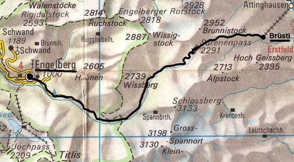 |
Brüsti to Engelberg -
|
Thursday 21st June 2001
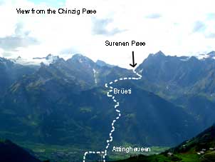
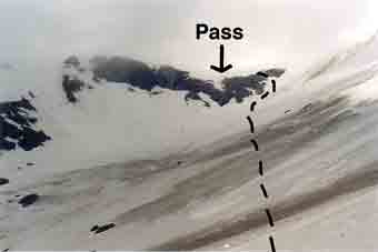
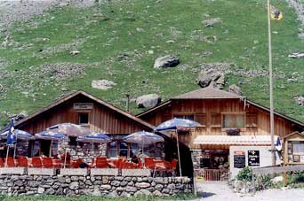
Up at 0450 & away by 0520 with a semi-somnolent Avis, who, after we arrived at Luton Airport in 45 minutes, took the truck back home. This was because one can no longer rely on the railway to get you to the airport in time, what with the Hatfield train crash & knock-on effects. I only had egg-on-toast for breakfast, as I could not face anything more exotic at that hour. The flight was 0740 but actually left at 0830, although it seemed to make up some time. I caught the 1140 train to Fluelen on Lake Lucerne & chatted to a girl (about 31) from Sierra Leone, about which I know, of course. It was quite hot in the valley, as I walked up to Attinghausen along the river mostly & then, flogged up to the cable car station, clearly getting blisters for my pains. I took it up to Brüsti, where Herr & Frau Eggmann welcomed me. I was force-fed a steak but Herr Eggmann showed me eagles, gemse & distant sheep with his field glasses, on the other side of the valley. The squirrels are fairly tame & trust Frau Eggmann's food (but be careful of squirrels in Der Schweiz: they can carry rabies). I walked out to take photos of the Surenen Pass high above in the distance, covered in snow.
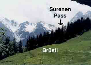
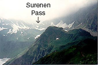
2001 photos. Surenen Pass from Brüsti |
Surenen Pass just above pt 2004. |
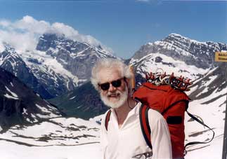
Ken at the top 2001 |
Friday 22nd June 2001 Surenen Pass LK245
Frau Eggmann served me quite a large breakfast at 0710 & I was away at 0743. It was still sunny but with drifting clouds. Large patches of snow started to appear at the East end of the Grat & it was solid snow from the narrow 2000m point onwards. Clouds blew in & out. There was no visible track above the point 2004m on the map & I just made my way, more of less on a contour, across the snowfield & avalanche debris, which is tiresome, as very inconsistent in texture here. I met the main track & wound up towards the pass, with quite a large party of what seemed like school children a couple of hundred metres behind me but they had disappeared when I got to the top, which was strange. Not as strange as what happened next. A lad was coming up the other side with a light pack. Having determined that we both spoke English, he introduced himself. So did I & he asked my surname. Baldry. We had corresponded through this web site by e-mail! Dan Hesson. We arranged to meet up for a beer in the evening (which we did, he bringing a couple of English girls who gave up on the snow, because they had not got a compass & could not see their way by then).
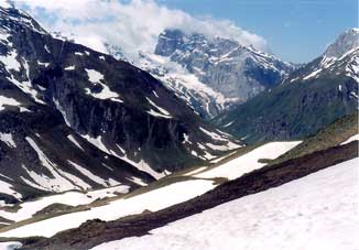
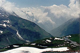
From the Pass looking West |
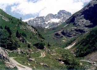
The path above Stafelalp, |
Stafelalp bunkhouse. |
We took photos of each other & I went down the much less snowy West side with magnificent views, to the Stafelalp bunkhouse for a coffee break before the long walk along the enchanting valley to Engelberg. When it joins the road, stick to it except the obvious short cut before the cable car station, as the views are better. My actual walking time was the 6 hours 50 minutes, the sign at Brüsti said. At the Hotel Engelberg, I showed the reception girl the reference to the hotel on the web site & she showed it to Herr Robert. No sign of Rosmarie. I cleaned up, checked at the gondola station that the Jochpass lift was open & went back for dinner with Dan, Laura & Jo. Blisters no worse than yesterday, to my surprise.
(I had tried the pass a week earlier last year (Friday 16th June 2000) & found it impossible because of bad ice. This year, I brought crampons but did not need them).
Engelberg to Attinghausen (Surenen Pass the 'wrong way') 1989
Sunday 16th July
The walk-in to Engelberg via Sachseln, Melchtal (stayed the night) and the Störegg Pass, which is road on the Melchtal side but a long path with some considerable 'up' on the Engelberg side. Then, a day exploring the hills north of Engelberg.
Wednesday 19th July 1989 Surenen Pass LK245
Up for breakfast at 0710 for the big day over the Surenen Pass. This is the really tough one. I left at 8, after saying farewell to Frau Rosmarie, the glorious Wirtin of the Hotel Engelberg. Engelberg is at 1000m. It was as long a flog as it looked on the map, with two hours of valley bottom walking before 'go'. I met an English couple there at the foot of the pass proper. They had stayed at the Stafelalp bunkhouse at the bottom of the real ascent overnight, having walked up from Altdorf. To do the pass from the Engelberg side, staying at Stafelalp is the sensible way, not try to do it in one. The Engelberg side was a straightforward pack-horse track. I practically crept up the last bit to the pass at 2291m, with enough people around to witness my humiliation but the other side was quite different.
1989 photos. |
From the Surenen Pass looking East |
Huge snowfields made me glad of my ice-axe. After dropping about 1000 feet, there was a long ridge (the Grat), quite narrow in places and not losing much height but it gave spectacular views down to the Urnersee on one side and a hanging valley on the other. It had a nasty joke at the end, where one had to go back steeply up a bit protected by cables. I staggered into the café by the cable car at 1525m feeling half dead. Unfortunately, there was a chatty local man to whom I talked as the Tour de France on the television swept into Alp d'Huez and we went down the pack-horse track together, an extra 3000 feet, he telling mostly untranslatable jokes. (Puns do not translate easily). One was about the end of his valley being where the girls became prettier than the cows. Since his valley lead into the Reuss, which leads into the Aare, which leads into the Rhine, I forbore to point out that his valley must therefore end in Basel. He gave me a lift into Altdorf from the cable car station in Attinghausen at 597m. Just as well, as, after I checked into the Golden Key Hotel, I fainted in the shower, I was that beat. It had taken ten hours, including rests. The Goldener Schlüssel was even dearer than the Engelberg but I was in no position to shop around.
For how to go about this in the 'right direction' (East to West), see the Klausen Pass alternative page and then above.
Thursday 20th July 1989 onwards
Various adventures further south, the Nägelisgratli above the Rhone Glacier highly recommended and ending up walking over the Brünig Pass back to Sachseln again.
|
Previous page on original route: |
Contact: Ken Baldry, 17 Gerrard Road, Islington, London N1 8AY +44(0)20 7359 6294 or e-mail him
URL: http://www.art-science.com/Ken/Alpine/XSwiss/alpine5.html Last revised 26/5/2012 © 1998-2012 Ken Baldry. All rights reserved.